We analyse the developmentof the project, with identification of the role of each research unit, with regards to related
modalities of integration and collaboration
DESCRIPTION OF THE WORK PACKAGES
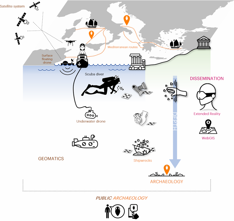
WP1 Collecting and structuring the available data in spatial informative systems
WP4 Extended Reality
WP2 Development of scientific and technological solutions
WP5 Communication and Dissemination
WP3 Testing and validation
WP6 Project Coordination and Management
Collecting and structuring the available data in spatial informative systems
The first activity is the survey of the state-of-the-art, through the
cataloguing of all the shipwrecks sites in the Ionian-Adriatic areas at various depths, considering their characteristics and environmental conditions, in order to provide a picture as complete as possible of the “potential” of the site. The organization and the architecture of the web GIS.
will be conceived in accordance with a hierarchization of information not only internal but also external, referred, for example, to the operational potential. The thought-out collection will confirm and identify the case studies, especially for the high depth.
Development of scientific and technological solutions
The techniques adopted in this phase are essentially those necessary to create the innovative measuring system of high-resolution data, both in terms of involved sensors and data processing procedures to overcome the specific problems related to the presence of the water medium.
Testing and validation
The proposed tasks lie in the evaluation and verification of the success of the methodologies and technologies developed in the previous steps. The versatility and the suitability of the proposed practices in real case scenarios will have to be also tested in
compliance with the operational issues and needs: security and mobility of the divers,
safety and integrity of the archaeological context and findings, underwater operability and data interpretation’s exigencies.
Extended Reality
Augmented\Virtual\Extended Reality (AR\VR\XR) applications have proven to be particularly effective in the CH domain, as they allow the discovery of details that are sometimes invisible to the naked eye or not easily accessible. We focus on the inclusion of different categories of participants who would often be ignored or marginalized.
A workflow based on content creation and exploration related to image and video analysis, synthesis and editing will be employed. The platform will be able to manage
heterogeneous kinds of multimedia, every of which can be used with
different devices, mainly virtually and in specific cases on-site.
Communication and Dissemination
Creating wide visibility for ARCHIM3DES objectives, activities, results, and benefits. Transferring ARCHIM3DES core messages
through a series of awareness-raising activities targeted to a general audience and strategic stakeholders at local, national and
international levels. Sharing experiences and best practices by carrying out networking activities with similar initiatives.
Project Coordination and Management
Set up an effective management framework for the consortium that ensures the project is managed according to the rules and
regulations. Provide technical, scientific and innovation leadership, and optimize the use of the partners’ expertise to ensure a
collaborative and efficient work plan implementation.
This WP includes the overall legal, contractual, financial and administrative management of the project.